Cyclone Nargis Myanmar Satellite Photo
The power of destruction produced by Cyclone Nargis was so immense. Take a look at the 2 photos below. You can see that the whole village was wiped out.
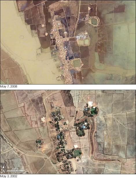
The scene captured by the Ikonos satellite on May 7, 2008, illustrates the complete devastation Cyclone Nargis brought to Burma (Myanmar) when it barreled ashore on May 3. This tiny village was located about 27 kilometers (16 miles) south of Yangon, the country’s largest city. In the lower image, taken on May 3, 2002, trees and buildings line a single street, which is surrounded by fields of crops, probably rice. After the disaster, the trees and buildings are completely gone, replaced by messy piles of rubble. [NASA]


Comments
Post a Comment